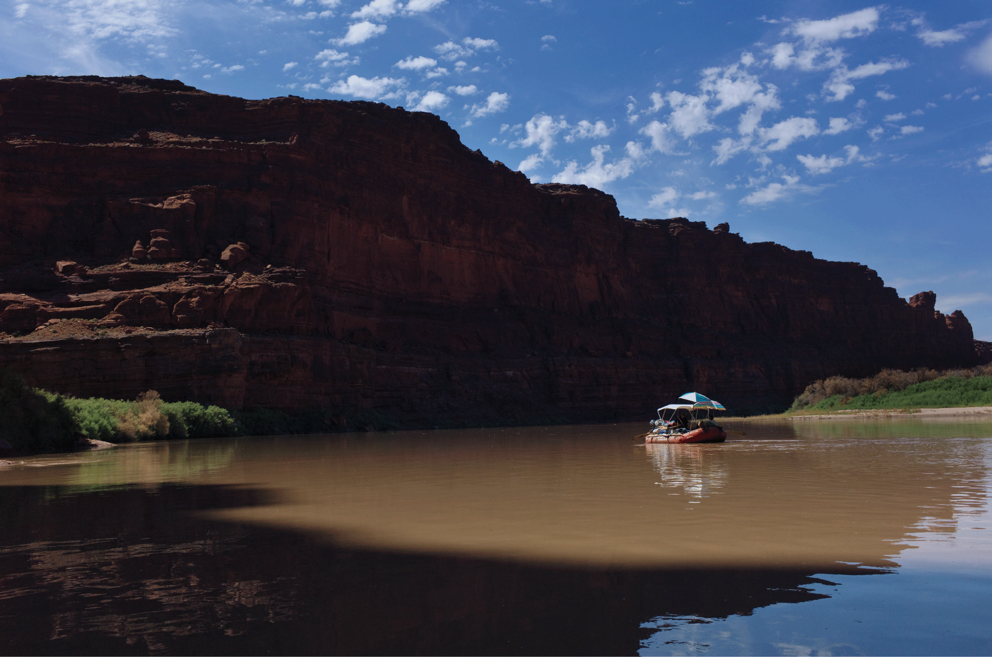
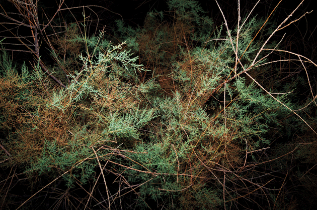
It was a river of drought, low enough that we could walk alongside the rafts, our feet sinking into the silky bottom. We had put in near Moab, Utah, at the mouth of Meander Canyon, where the Colorado River turns sluggish after racing out of the Rocky Mountains. There would be no worry about rapids for the next forty miles, not until Cataract Canyon, a stretch of white water that has a penchant for flipping boats and killing boatmen. Occasionally our rafts caught on sandbars and spun like lily pads, and we had to rally around them in the water and push. Where the flow deepened to the waist, a big-toothed writer named Bill deBuys, of New Mexico, who was once a finalist for the Pulitzer Prize for his book River of Traps, got out and swam. All but one of our party — the trip leader, John Weisheit, a slope-shouldered, slow-talking Moab river runner who had given up alcohol — popped open cold beers and jumped into the water, escaping the August heat as our boats drifted.
Colorado River, Canyonlands National Park. All photographs © Danny Wilcox Frazier
The water was warm as a bath and soft on the skin, and it shone lusty red from a brief summer monsoon days earlier that had churned it with the clay of flash flood. The CEO of Denver Water, a lawyer named Jim Lochhead, fit and efficient though sometimes jittery, with a mocking sense of humor and a habit of gnawing his cuticles, sipped his beer and dunked his head. “I claim this river for Denver Water and the verdant Front Range,” he shouted. The general manager of the Colorado River Water Conservation District, a nuclear engineer named Eric Kuhn, who had the endearing habit of inserting the word “okay” into his sentences at random, recited water statistics: historic flow, current flow, and the level of flow at which the Southwest would have to radically change its relationship to the river. “The quest for certainty,” he said, “is what the whole fight for this river will be about, okay.”
DeBuys, floating on his back, thought that matters were quite certain, that human demand had fatally outstripped natural flow, that with climate change the situation could only worsen. He had recently published a book about climate change in the Southwest. It was called A Great Aridness. As currently configured, deBuys assured us, the Southwest was doomed. It was the fastest-growing region in America, and most of its people lived in ever-expanding cities dependent for their water on a single river’s tenuous supply. “You know the three commonest Western lies?” said deBuys. “This pickup is paid for. I won this buckle in a rodeo. There’s water for this project.”
For the past fourteen years, the Colorado River has been at its lowest level since the ninth century. In 2012, the hottest year on record in the contiguous United States, when 60 percent of the country suffered drought, wildfires of exceptional size and fury had swept across the forests of New Mexico and Colorado. DeBuys did not envy Kuhn and Lochhead. As members of the bureaucracy that managed water for the seven states of the Colorado River basin, they would have to address these new challenges amid the bickering of local governments, some of whose claims went back more than a hundred years.
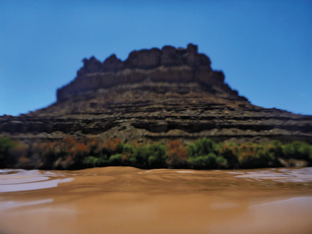
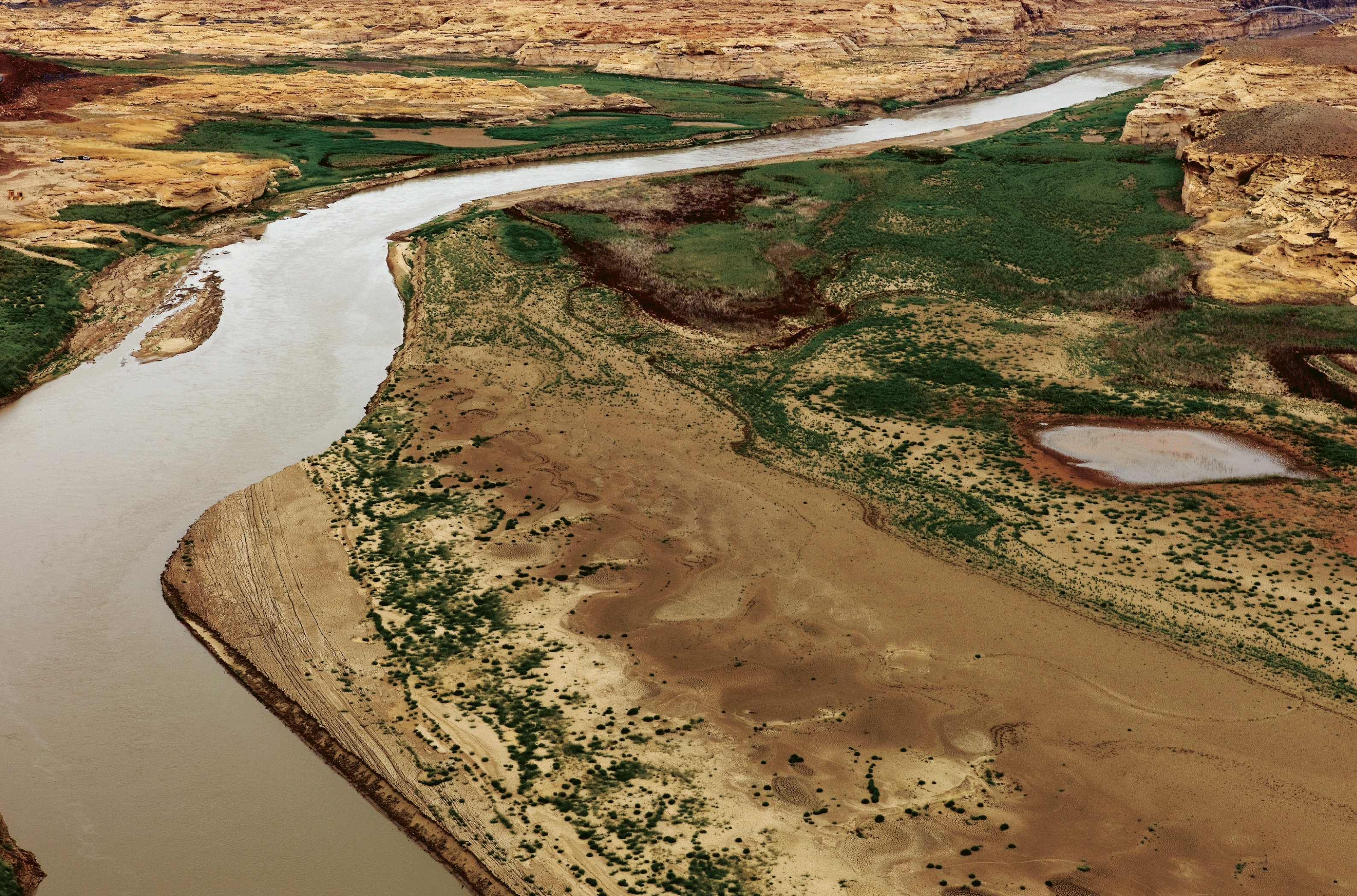
Meander Canyon above the confluence of the Colorado and Green Rivers
Before lunch, Weisheit, harrumphing that it was time to see some ruins that would inform the conversation, tied the rafts at a narrow beach lined with tamarisk trees. We gathered water bottles, soaked our shirts, cocked our hats, and hiked to a little granary once used to store maize, its sandstone blocks last mortared with river mud around 1250. Here, improbably, a civilization had once flourished. The Ancestral Puebloans, sometimes known as the Anasazi (Navajo for “enemy ancestors”), had thrived on the Colorado Plateau for hundreds of years prior to their society’s collapse circa 1300, when the desert heated up and the rain stopped falling. They left tiered cities, irrigation ditches, petroglyphs, and modest granaries such as the one before us. Drought had set an entire people adrift, in an exodus known to archaeologists as the Great Abandonment.
Our passage on the river traced, in part, the journey of John Wesley Powell, a self-taught geologist who lost his right arm to a minié ball at the Battle of Shiloh and came west after the Civil War to find his way into “the Great Unknown.” In the spring of 1869, Powell set out on the Green River in Wyoming with nine men in four wooden boats, bound for the confluence of the Green and the Colorado Rivers, thence to survey and name the major canyons of the Colorado where it passed, swollen and white, through Utah and Arizona. After sixty-nine days and 900 river miles, malnourished from a diet of coffee and spoiled flour, having endured extreme heat and cold, constant wetness, broken oars, leaky boats, threatened mutinies, and countless rapids run in a mad dash or portaged in hard toil, the Colorado River Exploring Expedition emerged from the Grand Canyon at the mouth of the Virgin River.
Powell led a second boat expedition through the canyons in 1871, published a best-selling account, and was acclaimed as a national hero on the order of John C. Frémont and Meriwether Lewis. He used his fame to secure from Congress funding for a new report on the Rocky Mountain region, and soon he took over the directorship of the U.S. Geological Survey, becoming in his time the premier expert — ethnologist, geographer, hydrologist, naturalist — to advise the federal government on how most efficiently to settle the arid lands of the West.
Along the banks of the Colorado River
Powell envisioned a rational West built with carrying capacity in mind. He proposed a radical reform: existing states and territories would be broken up and reconstituted as some 170 “natural districts,” locally controlled, their boundaries determined by “hydrographic basins.” Most unthinkably, he suggested that watersheds be held as common property, for water in the desert was power, and whoever controlled the water monopolized the land to be irrigated for hundreds of miles around. “Hold the waters in the hands of the people,” he said. Proceed otherwise, and “evils will result therefrom that generations may not be able to correct.”
Powell’s land reforms, wrote Wallace Stegner in Beyond the Hundredth Meridian, his biography of the explorer, were “so sober as to seem calamitous.” He was attempting to dissolve almost a century of legislation — the Northwest Ordinances, the Preemption Act, the Homestead Act, the Timber Culture Act, the Desert Land Act — that had supposedly been written to provide for the homesteader heading west but had mostly made it easier for ranching, mining, logging, and railroad companies to take over. The baronial interests organized to protect their investments. Thomas Patterson, a territorial delegate from Denver, denounced Powell as a “revolutionist,” a “charlatan in science and intermeddler in affairs” who was throwing “insurmountable obstacles in the way of the settlement of the public domain.” Senator William Stewart of Nevada, lawyer, ex-miner, land speculator, friend of the railroaders and the cattlemen, launched a campaign to discredit Powell. The booster editorialists in growing Western cities avowed that there was no scarcity: there was in fact more water every year, with every new farm established. Sow grain and plant trees and the foliage would shake water from the skies, they said, citing quack studies.
Powell had planned a comprehensive irrigation survey, but it was defunded before he could complete it. By 1893, when he was invited to speak at the second annual National Irrigation Congress in Los Angeles, he had concluded that his vision of a West tailored to carrying capacity would not be realized. More land than could sustainably be irrigated with water from the Colorado and the other great rivers of the West had already been parceled out. The delegates gathered at L.A.’s Grand Opera House called for still more. “O glorious land,” sang a choir brought in as entertainment, “where fruits purple, crimson, and golden roll forth from plenty’s horn.” Disgusted at the proceedings, the one-armed veteran stood to make his last public statement on the settlement of the West. “I tell you, gentlemen, you are piling up a heritage of conflict and litigation over water rights, for there is not sufficient water to supply the land.” The cornucopians howled and booed and hissed, and Powell departed the conference in a deep funk.
Two days after we stopped at the ruins, we landed at a white sand beach below the confluence of the Green and Colorado Rivers. We had camp chairs; a four-burner propane stove; five folding tables; sleeping pads the size of toboggans; tents; fifteen pounds of fresh meat; cucumbers and onions and tomatoes and heads of lettuce; 200 cans of beer; 150 cans of soda and sparkling water; a bottle of lime juice for cocktails; handles of rum, whiskey, gin, and vodka; several cartons of sweet snacks; and, for the evening’s penultimate relaxation, an old military-surplus ammunition can with a comfy if battered toilet seat fixed atop it.
Lochhead forgot that he was the CEO of anything, crossing the river to the far bank and back, doing a thrifty Australian crawl, emerging with a hooting cry. DeBuys and I found chairs and watched as the sun fell behind the canyon rim. The oppressive white light of the day softened, sweetened, turned pink and ocher and buff on the sandstone walls. A canyon wren sang its liquid glissando. We were on the edge of Cataract Canyon, and beyond the wren’s call we heard the echo of the rapids. Someone brought out the hard liquor. I learned that river managers in the West are pejoratively referred to as water buffaloes. Kuhn and Lochhead, henceforth our buffaloes, did not mind.
DeBuys asked the party what we saw in the water that carried us. “Kidneys,” said Lochhead, who was urinating into it. (Weisheit said this is sound practice in a desert ecosystem: the toxins in the piss are quickly diluted.) The river crawled away with the foamy urine patch. Kuhn thought a moment. “Uncertainty,” he said.
“I see property going down to its owners,” deBuys declared. “Every drop is spoken for.”
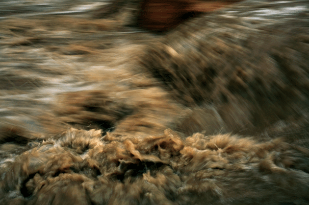
Rapid 19, Cataract Canyon, Colorado River
Weisheit called us quietly to the kitchen, and together we divided up the duties, chopping onions and preparing meat. I asked Weisheit what he saw in the water. He sighed. “Despair. That’s what I say when I see something dying.”
After thirty years of working for Utah outfitters on the river, Weisheit was sick of the guide business, which was peopled by “drunks who didn’t give a shit about the river.” He had founded, in 2000, the nonprofit Living Rivers, and, in 2002, had joined the Colorado chapter of the International Waterkeeper Alliance. He had read John Wesley Powell, and had rafted, in 1996, for more than one hundred consecutive days on the Green and Colorado Rivers, hewing to Powell’s white-water trail. He had run Cataract Canyon at least 350 times, had gotten married in Cataract Canyon, taken his honeymoon in Cataract Canyon, co-authored a book about the history of the river in Cataract Canyon, and, as director of Living Rivers, had been a plaintiff in multiple lawsuits against federal and state governments over their stewardship of Cataract and the water downriver in the Grand Canyon. He had lost every one.
We ate, and night fell, and the clear sky was filled with stars. We drank more. Kuhn and Lochhead offered us a history of the division of the water into property. It began with the National Reclamation Act, passed in 1902, the year of Powell’s death. The act established the Reclamation Service, now known as the U.S. Bureau of Reclamation, whose purpose was to industrialize — on a scale unimaginable to Powell — the rivers of the arid lands. The Bureau of Reclamation, its slogan “Total use for greater wealth,” would now parcel out the flow of water in the Southwest, establishing a degree of certainty previously unknown among the Colorado’s users: Reclamation’s vast dams and reservoirs would provide security of supply throughout the year and control the river’s maddening floods. In 1922, urged along by the federal government, representatives of the upper-basin states (Colorado, New Mexico, Utah, Wyoming) and the lower-basin states (Arizona, California, Nevada) arrived after much arguing and antagonism at an agreement for hydraulic management of the region.
The Colorado River Compact of 1922 was the product of, and an attempt to mitigate, a peculiarly American system of water rights expressed in the doctrine of prior appropriation. The person who first made “beneficial use” of a stream or river had first right to it. Qui prior est tempore, went the maxim, potior est jure. Under this doctrine, the earliest users of the Colorado River, notably the state of California, could legally establish a monopoly over regional water supply, even though 70 percent of the river’s water came from a single state, Colorado. The continual expansion of California’s agricultural sector — Colorado River water had been used as early as the 1890s to irrigate the Imperial Valley, where the population increased 350 percent between 1910 and 1930 — along with the growing thirst of its southern coastal cities, was claiming the water supply of the other basin states. California, first in time and strongest in right, had to be stopped — hence the compact.
The agreement’s deepest flaw was its assumption that the Colorado held more water than it really did. The annual flow estimated in 1922 was 17 to 18 million acre-feet. (An acre-foot is the amount of water required to cover an acre of land a foot deep and is equivalent to 325,851 gallons, enough to supply the home of a modern family of four for a year.) The negotiators for the upper basin guaranteed that their states would deliver to the lower basin 75 million acre-feet over any ten-year period, which was less than half the expected flow. By the 1930s, however, hydrologists had concluded that the earlier estimate was too high. The latest estimate, determined by studying ancient tree rings, puts the historic average flow of the river at just 14 million acre-feet. Thus the Colorado from the moment of its political division had been overallocated.
By the time Kuhn and Lochhead got into the business of water management in the 1980s — Kuhn started as an engineer with the Colorado River Water Conservation District; Lochhead was a water-rights lawyer for the state of Colorado — the region remained in the grip of its six-decade-old hallucination of abundance. Water buffaloes who pointed out the evidence of the river’s periodic stinginess were ignored or derided. The drought that catalyzed the Dust Bowl, when flow dropped to 12.7 million acre-feet, had ended with record snowpack in the Rockies that recharged the river, and so, too, had the droughts of the 1950s and the 1970s. The 1980s and 1990s were lavishly wet decades, the Colorado producing all-time highs of 24 million acre-feet in 1983 and 25 million in 1994, when huge snows fell in the mountains. Then, after 1999, dry air returned, and for the next fourteen years, despite two exceptional winters of recharge, drought hung over the Southwest.
The compact’s signatories had in the interim moved no further toward trusting one another. Our buffaloes, being upper-basin men, naturally did not hesitate to name California and Arizona, with their sprawling cities and industrial farms, as the problem children of the Colorado River. “The lower basin,” Kuhn told me, “is now overusing its share of the Colorado River by as much as two and a half million acre-feet a year. They can do this because the upper basin isn’t using this water — we use four million a year — and we give it to them. It’s not sustainable.” Kuhn and Lochhead agreed that a solution would not come from direct confrontation. Renegotiating the compact would lead to chaos. Arizona v. California, one of the longest and most expensive federal court cases in history — filed in 1952, decided by the Supreme Court in 1963, requiring the services of nearly fifty lawyers and two court-appointed special masters, costing the litigants $5 million in legal fees (about $37 million today), producing years of formal hearings and evidence from 340 witnesses — had already provided a glimpse of this nightmare. Though the Supreme Court affirmed that Arizona was owed 2.8 million acre-feet of main-stem water annually, the judgment stipulated that Arizona’s rights, under the doctrine of prior appropriation, would remain secondary to California’s — which suggested that, in an apocalyptic drought scenario, the taps in Los Angeles would flow unabated while Phoenicians groaned with thirst. California’s Imperial Irrigation District, among all entities in the basin, maintained the largest single claim on river supply, some 4 million acre-feet. The upper basin could of course renege on its delivery obligation — if it wished to start a civil war. “Renegotiation of the compact is politically impossible,” said Lochhead. Both he and Kuhn believed, however, that the rational decision-makers would muddle through the mess created by the compact so long as there was a “continuation of personalities,” an established field of technocrats who knew and trusted one another even if the political leadership was at odds. Stalemate had the benefit of stability.
In ancient arid lands where a single river was the source of plenty — in pharaonic Egypt, for example — irrigation societies arose that were remarkably uniform: governed by a divinely appointed despot, served by masses of laborers ordered to build the ditches, canals, and aqueducts that would draw an agricultural surplus out of the Nile, the Tigris, the Euphrates, the Indus, and, on a lesser scale, the Yellow River. The historian Karl Wittfogel, who in 1957 published his theory of hydraulic empires, observed that this “Oriental despotism,” as he termed it, was climatically determined. Aridity demanded absolutist government, along with a managerial class tasked with record-keeping, accountancy, communications and intelligence, the marshaling of manpower, and, eventually, oversight of the sort of urban expansion that produced the colossalism of the pyramid and the ziggurat. “Jealously defending their monopoly of political organization,” wrote Wittfogel, the water bureaucracies developed dynasties within their ranks. A mature hydraulic empire was thus highly resistant to change, working only “towards the reproduction of the existing order, towards its stagnation.” With time, he continued, “stagnation results in stereotyped repetition . . . or outright retrogression.” The managerial class could only do more of the same — until, as in Mesopotamia by 2400 b.c., the price of doing the same (irrigating to the point that the soil was loaded with leached mineral salts and the crops failed) was self-destruction.
Lake Powell
No hydraulic civilization in history was grander than the American West under the Bureau of Reclamation. After 1922, the monuments of empire were fastened on the Colorado River, which was declared “the American Nile,” the “Mother of an Occidental Egypt.” The Hoover Dam, completed in 1935, then the tallest dam ever constructed, impounded 28 million acre-feet of water in Lake Mead and generated electricity for sale mostly in California (the revenues helped defray the $49 million cost of construction, about $809 million today). The Parker Dam, completed in 1938, created Lake Havasu on the Arizona-California border, regulating the flow of water through the Colorado River Aqueduct to the Metropolitan Water District, which served the residents of southern California from Ventura to San Diego. The All-American Canal System, completed in 1954, fed the multibillion-dollar farms of the Imperial Irrigation District, along with its main ancillaries, the Coachella Valley and the Palo Verde Irrigation District. The Glen Canyon Dam, completed in 1966, created a reservoir of 27 million acre-feet, Lake Powell. Reclamation’s most ambitious and expensive hydraulic achievement was a 336-mile pipeline and aqueduct that ran east into Arizona from Lake Havasu. The Central Arizona Project, which was started in 1973 but not completed until 1994, allowed for the breakneck expansion of Phoenix and Tucson. The Colorado, Donald Worster wrote in Rivers of Empire, was “a part of nature that had died and been reborn as money.”
Today there are more than 200 dams large and small on the Colorado and its tributaries; total reservoir storage amounts to roughly four times the average annual natural flow. The system is interlocking and interdependent: Mead depends on outflows from Powell; Havasu and the web of canals and aqueducts downriver of it depend on outflows from Mead. (Between Lake Powell and Lake Mead is an obstacle called Grand Canyon National Park, part of which Reclamation engineers had also once hoped to flood.)
Studies of the effects of climate change on the Colorado River, issued in 2008 and 2009 by UC San Diego’s Scripps Institution of Oceanography, concluded that the river’s average annual flow could decline by as much as 30 percent by 2050. Without massively curtailed water usage, Lake Mead had a 50 percent chance of declining to “dead pool” by 2036 — dead pool being the level at which the reservoir’s surface has dropped below the lowest outlet of the Hoover Dam. At dead pool, Colorado water deliveries to millions of people in California and Arizona, as well as to millions of acres of farmland in both states, simply cease. Hydroelectric production at the dam, which provides power to more than a million consumers and requires a water level at least 155 feet above dead pool, will already have stopped.
The lead author of the Scripps reports, Tim Barnett, a marine physicist, had presented his findings in numerous meetings of water managers and elected leaders, including a 2009 conference of the mayors of California’s ten largest cities. The Colorado supplies 40 million people, the majority of them in cities, and that number was projected almost to double by 2060. “The mayors got the bottom line that the Colorado was exhaustible,” Barnett told me. “They asked, ‘What can we do about this?’ I said cut down development, stop growing so fast, so that we won’t have as many people needing water. Their reaction was like getting a series of electric shocks. I got a lecture about living and dying in San Jose from the mayor, who said that we have no right to tell people where they want to live, and that if someone wants to live and die in San Jose then by God we’ll find the water. It’s been this way for a hundred years. I don’t see a chance at reasoned solutions.” The goal of finding the water, described in technical parlance as “river augmentation,” had inspired the water-management bureaucracy to reproduce the existing order, but on a magnitude that was prohibitively expensive, politically fraught, and occasionally demented. Water was to be diverted in continent-spanning pipelines from the Yukon and the Tanana and the Susitna Rivers in Alaska; from the Churchill, the Slave, the Peace Rivers in Canada; and, nearer to home, from the Mississippi and the Missouri Rivers. Even the Great Lakes had been considered for transfer.
On the morning of the fourth day, before the heat set in, the party mustered out of camp with backpacks full of water and food for a hike to the mesa rim. The trail switchbacked up the cliffs, rising a thousand feet above the river into a labyrinth of eroded stone towers that were colored in bands of vanilla and rose and orange. “Wherever we look,” Powell wrote,
there is but a wilderness of rocks; deep gorges, where the rivers are lost below cliffs and towers and pinnacles; and ten thousand strangely carved forms in every direction; and beyond them mountains blending with the clouds.
By one p.m., our thermometer registered 111 degrees in the sun. Across this sere landscape, but for where our boats waited, there was not a significant source of water.
The party split up. Weisheit and I sat alone in the shade of the sentinel hoodoos. We drank like misers from our canteens and took off our shoes and toed the hot sand. I held my breath and heard nothing — even the breeze lay down in the heat. Weisheit described for me how ancient inland seas and deserts in succession, starting 300 million years ago, had deposited the beds of iron-rich red silt and mud and sand, layering them atop one another through the Permian, the Triassic, the Jurassic; how 65 million years ago a geologic event called the Laramide Orogeny lifted the region, creating the Rocky Mountains and the Colorado Plateau, and how in this uplift the rivers tilted, cutting ever deeper; how millions of years of erosion followed, with more than a vertical mile of sediment carried off by the rivers and their tributaries, by the rain and snow, by ice ages melted, water always sculpting the canyon lands, sculpting still, in even the lightest rain, the stone we sat on.
I asked Weisheit about his boyhood in Phoenix. Back in the 1950s, he said, it was a nice little town of orange groves. He had a paper route, and the weather got cold enough that on winter mornings there was frost on the ground. The groves were replaced by subdivisions in the mid-1960s. That cities like Phoenix and Las Vegas — “cities of death,” Weisheit called them — had been allowed to grow so big sticking their straws in the Colorado River was for him an affront to common sense, to science, to nature itself. “These cities will someday die from drought, and they deserve to die,” he said. “It happened to the Anasazi. It will happen to Phoenix.” His mother, father, sisters, brothers, cousins all still lived in Phoenix. His brothers ran an industrial refrigeration business and were doing well for themselves. “They have a pool, a hot tub, a TV above the bathtub. The truth is we’re giving water to wasteful people in the lower basin. They want more freeways, more houses, more pools, more climate-controlled environments, more casinos in Vegas. How much more do they want? They’re water-skiing in Palm Springs, for Christ’s sake, in the middle of the fucking Mojave Desert. And our buffaloes tell us everything is going to be fine.”
The next day, refreshed in the water, leaning on his oars, Weisheit was in a better mood. He teased Kuhn and Lochhead about his proposal to decommission Glen Canyon Dam — he suggested blowing it up. This would free the river to flow unobstructed into the Grand Canyon. Never happen, said the buffaloes. Weisheit suggested, as Barnett had, a moratorium on population growth in the basin. DeBuys, listening on our boat, quoted the writer Edward Abbey. “Continuous growth,” he said, “is the ideology of the cancer cell.” The buffaloes said this was delusional.
“Why?” asked Weisheit.
“Why what?” replied Lochhead.
“Grow! So we can all live like a cancer?”
“Look, Denver is working on being a vibrant urban core,” Lochhead said. “The problem is that there are forty to fifty suburban entities around Denver, and we’re providing water, on perpetual contract, to around half of them. We’re bailing them out. The developers, the real estate people, are going to build, and people are going to buy. Our system is based on that. Water managers don’t have the ability to approve or disapprove land use. As a general matter, utilities exist to serve future growth — to keep it going, but not to say, ‘Okay, we’re done.’ ” He was admitting, in other words, that the buffalo is a powerless creature. “I hate it,” said Lochhead, “but that’s the reality. We need people like you advocating for a different approach.”
“People like you,” said Weisheit, “laugh at me.”
Lochhead argued that agriculture was the true glutton of the Southwest. Denver Water was serving 25 percent of Colorado’s population but using only 2 percent of the state’s surface water, using in fact less water every year its number of customers increased. About 90 percent of all water diversions from the river went to irrigation. This was highly remunerative. Imperial County alone produced nearly $2 billion in crops and livestock in 2012. Nearly 50 percent of the agricultural diversions in the lower basin went solely toward water-inefficient arid-land crops like alfalfa that are used to feed livestock. In Lochhead’s view, this outsize share of the river, however enriching of industrial agriculture, however historically entrenched, would have to shrink as cities grew. “Cities are the more efficient use of water. Cities are where it’s at now,” he said. “We have the money, and the farmers who have the water will be willing to sell.”?1
DeBuys asked who in this debate was delusional. He said that farmers he had talked to, in the Imperial Valley, in Utah, in Colorado, in New Mexico, weren’t interested in giving up water rights. The farmers will fight, Weisheit agreed. Rural interests will be pitted against urban, state against state, upper basin against lower basin. DeBuys worried about the breakdown of rational decision-making in conditions of drought. Drought is not like other natural disasters. Hurricane, flood, storm, and fire devastate and then pass quickly, leaving behind communities united by the sudden trauma. Drought is gradual. It is geologic in its pace, and as it unfolds it erodes society’s confidence, goodwill, trust. “It gives people plenty of time,” writes deBuys, “to erect defenses, pick sides, and meditate on the defects of their neighbors.”
Around mile sixty of our trip, on the sixth day, we entered Cataract Canyon. Weisheit explained that here was the last stretch of the true Colorado, where the river was wild, free-flowing, unpredictable, and still colored from its load of silt.
We ran Capsize Rapid and Hell-to-Pay Rapid, and neither raft had trouble. At the approach to the Big Drops, a set of three rapids that culminate in a madhouse of froth called Satan’s Gut, we pulled onto a stony beach to scout. The party followed Weisheit through a tumbled garden of boulders to gain a view of the river from the tallest of them. “Poop Rock,” he said over the cacophony of the water. This was the site where river rats were supposed to shit themselves in anticipation.
The Big Drops roared and churned. Weisheit gathered us around him. He crouched on the boulder and spat, drawing a map of the rapid with his saliva, delineating on it our safe passage. The Drops consisted of a series of liquid ledges and boulders that could break oars and heads and tear open the bottoms of boats. Where the water raced over unseen rocks and plunged deeply on the other side, it formed holes that caused colossal standing waves. Holes had to be avoided. “We have to be like a pinball but never hit,” said Weisheit. “So: you don’t wanna boink here or boink here.” The spit was drying up. He sighed, spat again, and added: “And you don’t wanna boink here. Or here.”
John Wesley Powell had portaged the Big Drops, traveling fewer than three quarters of a mile in a day. I thought of him as we put back into the river. Weisheit waited and watched. The raft drifted. He pointed out the problem of keeper holes, where a rafter tossed from his craft ends up “Maytagged” in a terminal hydraulic recirculation, unable to escape the many hundreds of pounds per square inch of downward force — headed fast for a drowning. The current formed an eerily glassy tongue the tip of which lashed in froth at the first of the ledges fifty feet ahead, where the river alarmingly dropped off the face of the planet. Weisheit waited.
In rapids, paradoxically, time is slowest from the boater’s perspective. “I listen for the river,” said Weisheit. The rapid crawled toward us. “I see what the wind’s doing. I need to set up, find my markers. I let the water do the work.” He stood, his eyes casting about. “Now I’ve got my markers.” Two gigantic movements of his arms on the oars: the boat was now at a slight angle to the first of the ledges. I spoke to him. “Don’t,” he said. The oars again swept the water, a lighter plashing touch, two strokes, three. “Now I need . . . ” Another stroke. “This.”
The boat straightened out, shivered like a duck, whipped to one side and the other. The waves blocked out the sun. I caught a glimpse of Weisheit. He looked sleepy and was working his oars so gently that he seemed to be petting the water. I faced forward. The water walled up in Satan’s Gut, clattering and crashing and hushing, obscuring the canyon rims and filling them with a kind of liquid flame. Weisheit made another single stroke of the oars, swift and canny. The boat leaped, and gravity fell away.
We did this twenty-nine times over fourteen river miles, and as quickly as the rapids came at us they were gone; the white water in Cataract Canyon took less than two days to run. Immediately the current slowed again, bound for its terminus in the reservoir of Lake Powell.?2
We tied our rafts bow to stern, and Weisheit, seeing the current slacken ever more, hung a six-horsepower outboard off the back of his boat. The motor’s drone filled the silence. “I smell a hint of hydrogen sulfide, okay,” Kuhn said. The river bottom was rotting and releasing its fumes. “You’re getting decay in the sediment.” There wasn’t enough current to flush it clean. I asked whether this was still a river. There was not a consensus. Kuhn noted that if Lake Powell were drained, it would be a remarkably dangerous Superfund site.
“At the very lowest levels of the lake,” said Kuhn, “you get funny chemistry, okay. Anoxic conditions. Oxygen gets choked off. Lead, uranium, vanadium, selenium, arsenic, they precipitate out. If Lake Powell is gone, what’s left is toxic sludge.”
A half hour passed, and we took turns leaping into the water, which began to stink truly.
“I’m gonna vote no, not a river,” said Lochhead.
That night, we made our last camp, at a beach that had recently been uncovered by the receding reservoir. The ground was a hideous patchwork of cracks where the heat of the sun had split it open. The vegetation was gone, the birds were gone, the beavers were gone. Weisheit said we might as well have camped in Phoenix. The next morning, after untying the boats, he stood on the edge of the broken ground and scratched his belly, squinting in the sun at the river’s stillness. “Oh despair,” he said.
Three months later, in December 2012, I flew to Las Vegas to attend the annual conference of the Colorado River Water Users Association, which included delegations of water managers from every basin state. The event coincided with the publication of a long-awaited report by the Bureau of Reclamation, the 2013 basin study, four years in the making and expected to map a feasible future of water supply in the Southwest. Eric Kuhn had flown in for the occasion, along with Weisheit, who picked me up at the airport looking unrecognizable in new jeans and a clean fleece. Weisheit and I drove through the havoc of light and noise on the Strip to the CRWUA’s traditional meeting place, at Caesars Palace. Next door, we could see the Bellagio’s nine-acre lake, with a fountain that danced to Broadway show tunes. (The water for the fountain came from the casino’s private well.) “If your life is empty, this is where you go,” said Weisheit. “False, vain, stupid, consumptive. If the whole world were like Vegas I’d kill myself.”
On the first day of the conference there was the grand opening of the exhibits room, where scores of buffaloes, who for the most part were aging white men headed for obesity, were courted by vendors of the technology of hydraulic civilization. I learned about pipeline systems and canal liners and butterfly valves and mud valves and sluice gates and tilting weirs. “A roomful of fucking lunatics,” muttered Weisheit. “Kuhn and Lochhead are the most progressive water managers in the whole basin compared to these guys.”
I asked Robert Johnson, who served as commissioner of the Bureau of Reclamation from 2006 to 2009 and was now a water consultant whose clients included the Southern Nevada Water Authority, whether he had any sense of the total carrying capacity of the Colorado basin. He told me with chipper reassurance that Reclamation had been investigating river augmentation — piping water from the Mississippi and Missouri Rivers, for example. “There are solutions. They are expensive. They will take time. It won’t be easy.” I asked again whether Reclamation had examined the basin’s carrying capacity. “Carrying capacity,” he said, and stared at me. “I don’t quite know what you mean. You’re assuming that water is a limitation on growth? Because you can almost always find water to meet needs. Why is water any different than other necessities for growth, like lumber, like electricity? Water is not the limiting factor in economic development.”
What then, I asked, are the ecological constraints on growth? “You can have your cake and eat it too,” said Johnson. “It’s just going to cost more.”
“There are no constraints?”
“I am not God,” he said. He was becoming exasperated. His mustache twitched. “I don’t have an answer, and I don’t know anybody who does have an answer,” he said. “I’m sensitive to ecological constraints, don’t get me wrong. I really am sensitive.”
On the second day, Reclamation unveiled its basin study in a morning-long presentation. By 2060, we were told, the basin would face annual shortages of as much as 3.2 million acre-feet, the amount of water currently used by 13 million people. “The study is a four-million-dollar statement of the obvious,” said Kuhn, adding that, indeed, the assumptions in it were falsely optimistic.
The buffaloes crowded around an open bar to celebrate Reclamation’s achievement, and I got myself two whiskeys. When Weisheit was at the nadir of his alcohol addiction, in his thirties, he was consuming five liters of wine a day and waking in the night with the shakes. He was dying. “I got a second chance,” he told me. “When you get a second chance, you move beyond the present, you think about the future. The buffaloes are alcoholics all sitting in the same bar, all in denial. Water is a renewable resource, but the only reason we can move it around is nonrenewable — cheap energy. Cheap energy won’t be here in fifty years. You import more water, you bring more people to live in the desert, and then what do you do fifty years from now? Oops? We fucked up? Didn’t know it was coming? It’s just a setup for heartbreak for millions of Americans coming to settle the West. Just what John Wesley Powell had warned against, what he wanted to avoid. What other city most typifies heartbreak? That’s why this conference happens in Las Vegas. That’s why we’re at Caesars Palace, which honors a civilization that collapsed.”
One evening during a break in the conference, I drove thirty-five miles east, to the Hoover Dam, gazing from the shore at Lake Mead’s lost elevation, which then stood at 1,120. (A year later, in December 2013, it was at 1,107 feet.) I arrived at the dam at dusk, and the security crew told me I had just a few minutes to walk up and down the length of its top deck before closing time. Loudspeakers played recorded loops that told of the taming of “the most dangerous river in the world,” how “in the shadow of Hoover Dam one feels that the future is limitless,” how “in the same way the pyramids represent Ancient Egypt, or the Colosseum represents Rome,” so the Hoover Dam represented the “building genius of America.” A voice from the loudspeaker told me to gaze at a celestial map that had been inlaid into the top deck of the dam. It marked the position of the stars on the date the dam was dedicated, so that future generations could infer that date if all other records were lost. Up canyon there was the stone stillness of the impounded water, which fell lower by the day.