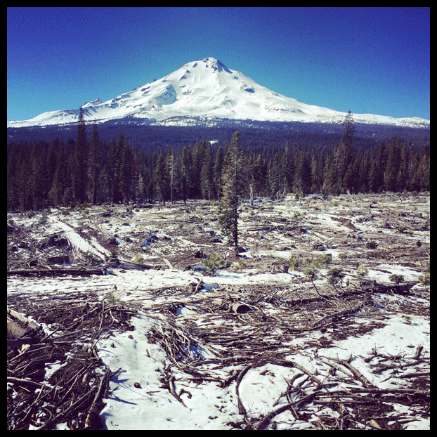
Mount Shasta. Photograph by the author
On a 50-degree morning in northern California, I could see thin streamers of snow blowing from Mount Shasta’s summit at the southern end of the Cascade Mountain Range, more than 10,000 vertical feet above me. But down on the asphalt of Interstate 5, there wasn’t a trace of the white stuff. Though it was early March, still nominally winter in the high country, the sun shone brightly, and the vegetation along the roadside sparked with flecks of green.
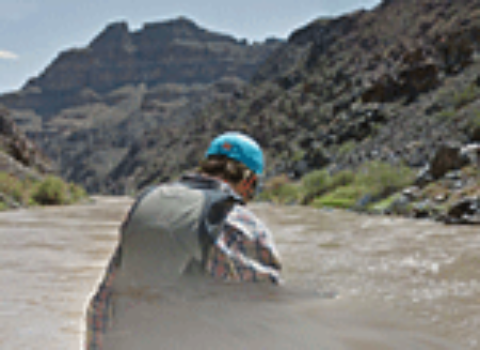
I had come to the small town of Mount Shasta, four hours north of San Francisco, to meet with Nick Meyers, the lead climbing ranger at the U.S. Forest Service’s Mount Shasta Ranger District. The wiry 32-year-old, sporting a thick mustache and a trucker hat, has arguably spent more time on the mountain than anyone else in the past decade. In addition to running the Mount Shasta Avalanche Center during the winter, Meyers spends three to five days a week on the mountain’s slopes, summiting the 14,179-foot peak as many as fifteen times per year. During those high alpine rounds, he’s become intimately familiar with the mountain’s seven recognized glaciers—remote patches of permanent ice that flow through steep gullies and cling to broad cirques along the peak’s sprawling summit. Shasta’s ice formations, like those in mountain ranges across the American West, are holdovers from the Little Ice Age, a centuries-long period of colder temperatures and growing ice sheets—which came to a conspicuous end around the beginning of the Industrial Revolution, in 1850.
Meyers offered me a chair at his desk and clicked open a folder containing dozens of images of Shasta’s snowfields and glaciers. The photos were taken last summer as part of a larger project headed up by Portland, Oregon–based glaciologist Hassan Basagic to document changes to glaciers in the western United States. Using GPS coordinates, each image was matched carefully with photos taken on earlier expeditions. The oldest were grainy and in black-and-white. One picture showed the Whitney Glacier, the longest on Shasta (and in California), which courses through a steep, rubble-filled chute on the mountain’s northern slopes. He traced his finger over the screen, clicking between the newer and older images, pointing out slight but definite differences—here, a long finger of snow replaced by gray patches of dirt and rock; there, a grayish blob of ice the texture of corduroy, where once a vibrant white patch of snow lay.
In 1875, John Muir wrote of Mount Shasta and California’s other glaciated peaks in an influential article for this magazine, titled “The Living Glaciers of California.” His musings on Shasta were, in part, based on experiences from a visit he’d made to the mountain a year earlier. From his haunts in Yosemite he plodded north, along the California and Oregon Stage Road (on foot, of course) from Redding to the small outpost of Sisson’s Station, near the Oregon border. When he arrived on November 1, Shasta rose before him like a great sugar heap. Although early season storms had buried the mountain under nearly ten feet of snow, he climbed upward, using his packhorse as a snowplow to break through the highest drifts. “Some places I had to creep, and some places to slide, and some places to scramble, but most places I had to climb, climb, climb deep in the frosty snow,” wrote Muir of his November ascent.
The ice- and snow-loving Scotsman would hardly recognize Shasta, or the rest of California, in its parched state today. This winter has been the warmest in 120 years of recordkeeping. And for the last few years, a force field–like ridge of high-pressure air hovered off the California coast during the last couple winters and sent storms careening north of the state, depriving the coast, peaks, and valleys of vital precipitation.
1 California drought reporting tends to involve certain tropes and paradigms (I know because I’ve fallen back on them myself). Most times, the state’s chronic lack of water is framed as a political squabble between northern and southern California, or a hydraulic death match between urban and agricultural users. Thus, drought reporting tends to emphasize the places where the water is being used rather than where it originates. One benefit of this year’s stark snow totals is that the formula has been reversed, at least for the moment, reminding the public that the key driver of drought is not politics or regional affiliation but precipitation—specifically, snow.
At the beginning of April, the metrics of the California drought went from serious to critical. Surveyors announced that the water content in the state’s snowpack (determined by taking measurements at dozens of sites) was a mere five percent of average, the lowest since 1950. Governor Jerry Brown announced a package of water saving measures including a 25 percent cut in urban water use, the state’s first-ever mandatory water restriction. A month later, the state’s May snow survey at Phillip’s Station, 90 miles east of Sacramento, was cancelled altogether for the simple reason that there was no snow to measure.1
Historically, California has gotten roughly a third of its water from snowmelt off the Sierra Nevada, but the future looks bleak for these snow reservoirs. The Department of Water Resources projects that the Sierra’s snowpack statewide will dwindle by 25 percent by 2050. That diminution is the product of rising average temperatures, which current models project will increase between 4.7 and 10.5 degrees Fahrenheit by the end of the century. As the air warms, more of the precipitation that does fall will hit the ground as rain rather than snow, meaning that runoff to California’s rivers, lakes, and reservoirs will come more frequently in large flood-like bursts rather than slow, steady pulses. That makes water storage and delivery to downstream farms and cities difficult, as water must be rapidly released from reservoirs below to make room for the runoff rushing in. And as more rain falls at higher elevations, dousing snowfields atop high peaks, the snowpack of the Sierra and Cascades will disappear even faster.
This long-term pattern of fading snowpack can be seen in the state’s glaciers, which move downhill under their own weight. These ancient formations are not merely beautiful; they are just about the best long-term indicators of climate change we have. Glaciers in the Sierra Nevada, like their counterparts elsewhere in the western United States, have ebbed dramatically, losing about half of their surface area in the last century.
On Meyers’s advice, to get a better sense of the dearth of snowpack on Shasta’s lower slopes, I drove a semicircular route on a maze of service roads on the mountain’s eastern side. I passed heaps of cement-colored debris piled up along Mud Creek, remnants of last September’s flood from the Konwatikon Glacier on Shasta’s southern flank, which sent a slurry of pale ash and huge boulders careening down the drainage. The pavement soon gave way to volcanic scoria, but the road remained dry. I continued upward, sure deep drifts would eventually block my progress. But for mile after mile the road was a Mars-like red, crunching satisfyingly under the tires of my Volkswagen.
At about 6,500 feet, I finally encountered snow, but not much. I parked and hiked in tennis shoes and jeans onto a clear-cut mountainside. Where there should have been five to six feet of snow I found only the thinnest skiff of frost. Beyond, the summit of Shasta glittered under an electric blue sky. The seven glaciers buried beneath the snow would not be visible until this season’s melted away. But once that happens, the rapid erosion of its glacial ice is sure to resume.
2 According to 2014 measurements, the Lyell has now lost 78 percent of its surface area; the Maclure has lost 65 percent.
3 The Maclure turned out to be a more interesting case; although it had lost a similar percentage of its surface area, it was still grinding down at a rate almost identical to what Muir had measured, 140 years earlier, at a clip of “forty-seven inches in forty-six days, or about one inch per twenty-four hours,” as he related in Harper’s Magazine.
4 Stock last measured the growth of the Shasta glaciers more than a decade ago.
This new narrative of Shasta’s rapidly melting ice sheets ran counter to everything I thought I knew about the peak. A few years ago, I volunteered for a glacier survey trip headed by Yosemite’s geologist Greg Stock to measure the rapid retreat of two of California’s best known and most imperiled glaciers, the Lyell and Maclure, situated in the highest reaches of Yosemite National Park. Based on measurements collected over several seasons, Stock and his colleague, University of Colorado glaciologist Robert Anderson, found that the Lyell had lost 68 percent of its surface area and nearly 80 percent of its volume since the 1880s.2 In some places, that erosion has translated to the loss of more than 100 feet of ice thickness. More ominous was their finding that the Lyell Glacier has stopped moving altogether—meaning that, by all objective measures, the Lyell is no longer a living glacier at all but a dead patch of ice.3 One night, while camped beside a beautiful, unnamed lake in an alpine basin below the two ice sheets, Stock mentioned the strange anomaly of Mount Shasta. Over the last half century, he said, unlike the Lyell and Maclure, Shasta’s seven glaciers had been growing.4 From that night on, the mountain had loomed in my imagination as a last stronghold of alpine glaciers in the West.
5 After its release, the report stirred predictable angst among conservative commentators and climate change deniers, who used Shasta’s growing glaciers as evidence of the great hoax of global warming. Few of those who used the study to attack climate science, it appears, bothered to read as far as the final sentence of the study’s abstract, which states that rising temperatures predicted in models will result in the “near total loss of Mount Shasta’s glaciers by the end of the twenty-first century.”
As I would later discover, however, evidence for Shasta’s improbable resistance to warming temperatures can be traced back to a single study published in 2006 by two UC Santa Cruz glacier researchers, Ian Howat and Slawek Tulaczyk. Using aerial photographs, Howat and Tulaczyk found that the peak’s glaciers had in fact grown by thirty percent between 1951 and 2002, with the Whitney Glacier advancing downhill by more than a half mile. The team posited that the growth was triggered by an increase in spring precipitation. The mountain, speculated the researchers, inhabited a kind of geographical sweet spot, collecting huge volumes of snow from moisture-laden storms surging in off the Pacific, a phenomenon they called a “snow-gun effect.” Paradoxically, global warming seemed to have benefitted Mount Shasta’s glaciers—in the short term at least.5
In the years since the report was released, with California mired for most of that period in severe drought, some have been skeptical of the notion that Shasta’s glaciers are immune to the ravages of warming temperatures. Mauri Pelto, an environmental science professor at Nichols College in Worcester, Massachusetts, who studies glaciers located on volcanic high peaks, or “stratovolcanos,” along the U.S. Pacific Northwest, told me that most of the growth of Shasta’s glaciers took place between 1949 and 1979, a period in which glaciers on all of the Northwest’s stratovolcanos, including those found on Mount Rainier and Mount Baker, grew significantly.
After 1979, says Pelto, all of these glaciers, including Shasta’s, stopped advancing—many shrank markedly. But then, in the 1990s, Shasta’s glaciers got a boost as an El Niño phase brought heavy snows to the peak, causing them to once again grow while those on the other stratovolcanos continued to shrink. “That’s the anomaly,” said Pelto. “It’s real. But it’s not that [Shasta’s glaciers] were miraculously advancing for the last 70 years while these other ones weren’t.” By 2003, however, the heavy snows had ceased on Shasta, and its glaciers once again began to ebb. Today, he said, they’ve given up the gains seen in the early 1990s. “It’s really evident how quickly these glaciers have been retreating, particularly in the last five years,” he said, citing satellite images that captured the dwindling size and changes in patterns of crevasses, deep fissures running through the surface of the ice.
Andrew Fountain, a glacier researcher from Portland State University, believes he has an alternate explanation for the advance of the Whitney Glacier between the 1990s and early 2000s. Using LIDAR, a laser-based ground surveying technique that allows calculation of precise elevations, Fountain has found that all of Shasta’s glaciers have thinned. (A glacier’s thickness, along with the steepness of its bed, is a key determinant in whether it continues to move—which is to say, whether or not it is still a glacier.) “If a glacier is getting longer and also thinning then it’s not behaving like a regular advancing glacier,” says Fountain. “There has to be another mechanism.”
Though he has not yet published his findings, Fountain believes that mechanism may be a “kinematic wave,” a phenomenon observed on the glaciers of Mount Rainier. Kinematic waves, said Fountain, tend to occur on thin glaciers that receive an unusually large snowpack, typically on stratovolcanos. This mass of snow causes a bulge to form on the glacier’s surface. Over time, that bulge flows downhill, like a very slow-motion wave, cresting over the icy bed. “By the time it gets to the end of the glacier where the terminus is, that bulge forces the front of the glacier further downslope,” says Fountain. These pulses of snow, which can take decades to travel the distance of the glacier, can give the false appearance of an advance, even when the larger ice structure beneath is stagnant or in retreat.
Seen from on the mountain, the retreat and thinning described by Pelto and Fountain appears even more pronounced. “Overall, they are definitely shrinking,” said Nick Meyers, as he gestured to the images on his computer. “They look dry. They’re all covered in dirt. They don’t look like healthy glaciers—they look like shriveled-up old raisins.”
Later that afternoon, I drove to a trailhead on the western side of the mountain. About a half mile up the snowless trail, at an elevation of about 5,000 feet, I found a small clearing and plunked down my tripod, setting my camera to snap a picture of Shasta’s summit every 20 seconds. The shutter clicked; flies buzzed; manzanita bloomed. As the light declined, I counted a dozen or so hikers stealing a lovely winter evening hike—one that in years past would have required snowshoes and a heavy parka—hurriedly descending toward the parking lot. I stayed a little longer, drinking a beer as I watched the great cone turn from silver to pink to blue and finally to black. Only when the sun dropped entirely below the horizon was I forced to don a coat. My return trek was in darkness but required no “sliding” and “scrambling.” Needless to say, I was no Muir—and this was not the same mountain.